Towering cliffs. Panoramic vistas. Caves, waterfalls, and fire-scarred slopes. Hiking Mt LeConte is the #1 thing to do in Great Smoky Mountains National Park.
Mount LeConte is not the Smokies’ highest summit (that’s Clingman’s Dome). Nor is it the park’s hardest hike. But a trek to the top provides a sense of journey unlike anything else in the Southeast. Ask any Smokies local what their favorite mountain is, and you’ll overwhelmingly hear “LeConte.”
While Mount LeConte is a serious mountain summit, it’s also attainable for most fit people regardless of experience level. The key is to choose your trail wisely. On the flip side, if you’re looking for a seriously challenging climb, you can find it when you hike Mt LeConte!
I’ve hiked the Smokies’ most beloved mountain several times, from just about all directions. In this post, I’ll walk you through all the details you need to plan this trip.
Hiking Mt LeConte length and difficulty

Mt. LeConte is a moderate-very difficult hike, depending on your trail choice. Routes range from 11-18 miles, and from 3,000-4,000 feet in elevation.
Plus, after you reach the end of the trail, you’ll have to hike even further for views. The two main viewpoints are Myrtle Point and Clifftops. Clifftops is 0.3 miles beyond the lodge, while Myrtle Point is 0.5 miles away.
If you want to go to all the viewpoints, the official summit, and the lodge, you’ll add about 1.7 miles to the official trail lengths.
The good news is, the popularity of Mt. LeConte means the trails are well-maintained and not egregiously steep. (Bullhead is the exception on both counts.) You won’t have to contend with tons of blowdowns, deep water crossings, or thick mud. Trails are also well-marked — advance navigation skills are not required for hiking in the Great Smoky Mountains.
Which trail should you choose for hiking Mount LeConte?

There are five trails that run to the LeConte summit. They vary widely in length and difficulty.
It’s possible to hike up one trail and down another starting from the Rainbow Falls parking lot in Gatlinburg. You can mix and match Bullhead, Rainbow Falls and Trillium Gap.
The other two trails — Alum Cave and Boulevard — are standalones. However, you can combine them with a short shuttle. I always use AAA Hiker Service for my shuttles in the Smokies.
Alum Cave Trail to Mt LeConte

The Alum Cave Trail is the most popular and easiest trail to Mt LeConte. In fact, in a park with over 800 miles of trails, this hike is the 4th-most popular overall! It’s the #1 choice for first-time LeConte hikers.
It’s also the best Mt LeConte trail if you want to balance scenery and difficulty. Interesting features will help you forget you’re climbing, and it’s never excessively steep.
The trail begins from a large parking area with restrooms on Rt 441, a few miles into Tennessee from Newfound Gap. It meanders along a creek and crosses a few log bridges in the first mile. Then, it climbs through Arch Rock — a natural arch (yes, we have them on the East Coast too!).
Your first view comes at Inspiration Point, shorty before the namesake Alum Cave. Here you’ll leave some of the crowds behind as you begin the steeper climb through the pine forest.
At about 5 miles, the trail hugs a rock face where you’ll navigate using cables cut into the rock. The views of the western Smokies are spectacular. It’s a short-but-steep final climb to the lodge.
It would be reasonable to attempt the Alum Cave Trail if you’re in decent shape but not an experienced hiker. Children as young as 12 could comfortably complete this climb.
Distance: 11 miles to the lodge
Elevation: 3,000 feet
Difficulty: Moderate
Good for: Inexperienced hikers, families with children
Additional features: Inspiration Point, Arch Rock, Alum Cave
Time required to hike: 6-8 hours
Rainbow Falls Trail to Mt LeConte

Perhaps the easiest of the Mount LeConte trails, the Rainbow Falls Trail passes one of the best waterfalls in the Smokies on its gradual meander up the mountain.
The trail begins a couple miles outside Gatlinburg. There’s a medium-sized parking lot with restrooms, but roadside parking up to half a mile away is common in summer.
The first two miles of this hike — until you reach Rainbow Falls — are uncomfortably crowded. This stretch is flat-ish, wide, and a bit on the muddy side. You’ll rock-hop a stream just before reaching Rainbow Falls, the first major landmark.
From here, the crowds virtually disappear. It’s another 6 miles through the green tunnel to Clifftops. You’ll get some views in a small burned area shortly after Rainbow Falls. There’s a turnoff to another “overlook” near the top, but it’s not worth the diversion.
Although it’s longer and you gain more elevation, Rainbow Falls is a little easier than the Alum Cave Trail. It’s also a good choice in winter because it lacks the exposed rock faces of Boulevard, Bullhead and Alum Cave.
If you do a loop with Bullhead or Trillium Gap, it’s best to descend Rainbow Falls. This will allow you to see the waterfall at the end of the day and avoid crowds in the last couple miles, when it’ll be late.
Distance: 13 miles to the lodge
Elevation: 4,000 feet
Difficulty: Moderate
Good for: Waterfall lovers, winter hikes
Additional features: Rainbow Falls
Time required to hike: 7-9 hours
Trillium Gap Trail

The Trillium Gap Trail is another moderate option to reach the summit of Mt. LeConte. It’s shorter and gains less elevation than Rainbow Falls, but also has fewer features.
The hike begins from the Grotto Falls parking area outside Gatlinburg. If you choose to do a loop with Rainbow Falls, bear in mind that the trailheads are about 0.6 miles apart and it’s easier to park at Rainbow Falls.
The main feature you’ll pass on the way up is Grotto Falls. It’s a smaller waterfall, but known for the fact that you can walk behind it. Again, this is a very popular day-hike, so expect the trail to be mobbed for the first two miles here.
Trillium Gap is one of the more crowded routes to the summit of LeConte, so expect to see more people than on Rainbow Falls, even after you pass the cascade. Additionally, if you hike on a Monday, Wednesday or Friday in season, you may pass a llama train on the way to the LeConte Lodge!
The climb up Trillium Gap is a little more moderate than Rainbow Falls, although it gets steeper close to the summit. If you do a loop with Rainbow Falls, it’s best to ascend the Trillium Gap Trail to avoid the worst crowds on Rainbow Falls.
Distance: 12.5 miles to the lodge
Elevation: 3,000 feet
Difficulty: Moderate
Good for: Inexperienced hikers, waterfall lovers
Additional features: Grotto Falls
Time required to hike: 6-8 hours
Boulevard Trail

Now, we’re getting into the more challenging ways to hike Mount LeConte. The Boulevard Trail is long and the final climb is difficult — but it also passes so many spectacular views, you’ll forget how tired you are.
This hike starts on the Appalachian Trail from Newfound Gap. After about 4 miles of climbing on the AT — the hardest part of the hike — you’ll turn left onto the Boulevard Trail.
Keep an eye out 0.2 miles in for the turnoff to the Jump-Off. This steep cliff offers great views of the Sawteeth (the Smokies’ northern ridgeline). You’ll also cross the summit of Mt. Kephart, another 6,000-footer. The diversion adds about half a mile to your hike.
Back on Boulevard, the trail flattens out and climbs gradually through green tunnel for a good, long while. You’ll hardly think you’re even summiting a major mountain — but you are gaining elevation.
Just over half a mile before the summit, the views open up. You’ll cross a rock face with views of the Sawteeth, a break in the trees where you can see the Tennessee Valley, and the high, rugged slopes of LeConte just below the summit.
Unlike all the other trails, Boulevard actually ends at the true summit — marked with a giant rock pile. So the easiest view is Myrtle Point, which is only 0.3 miles off-trail (look for the sign to your left). Clifftops adds another 0.75 miles each way.
After you leave the AT, you’ll see hardly another human your whole hike on the Boulevard Trail.
Distance: 18 miles to the summit, not including the Jump-off
Elevation: 4,000 feet
Difficulty: Difficult, mainly due to the distance
Good for: Long-distance hikers, anyone wanting solitude, South Beyond 6,000 hikers (due to the easy tag of Kephart)
Additional features: The Jump-Off and summit of Mt. Kephart
Time required to hike: 8-12 hours
Bullhead Trail

Simply spectacular. Epically exhausting. The Bullhead Trail is the most epic Mount LeConte trail, but it should only be attempted by very experienced hikers.
The hike shares a trailhead with Rainbow Falls and is typically done as a loop with that trail (ascend Bullhead). It starts with a brutally steep climb straight up the ridge. 4 miles in, you reach the pine forest and…keep climbing. And then you climb some more, all the way to the summit.
So why would you subject yourself to this difficulty? Because the tragic 2016 fire wiped out just about all the vegetation on this side of the mountain. You’ll have near-180 degree views of the Tennessee Valley almost the whole way up.
Bullhead’s difficulty doesn’t only lie in its steepness. It’s also completely covered in blow-downs, some of which are quite difficult to cross. On some exposed stretches I wasn’t able to hike more than 2 or 3 minutes before clambering over another tree. Blowdowns add significant difficulty to a hike, and take much more energy to navigate than a maintained trail, so bring plenty of extra snacks to accommodate this.
While Bullhead doesn’t have any special features beyond its burned slopes, it’s still my favorite way to summit LeConte. You have a good chance of seeing zero other people until you reach the lodge. But again, you should be a very experienced hiker capable of long days in big mountains to tackle this trail.
Distance: 15 miles to the summit
Elevation: 4,200 feet
Difficulty: Difficult, steep, lots of blowdowns
Good for: Very experienced hikers who don’t mind a challenge in exchange for solitude
Additional features: Panoramic views nearly the whole way
Time required to hike: 8-12 hours
Backpacking Mt. LeConte

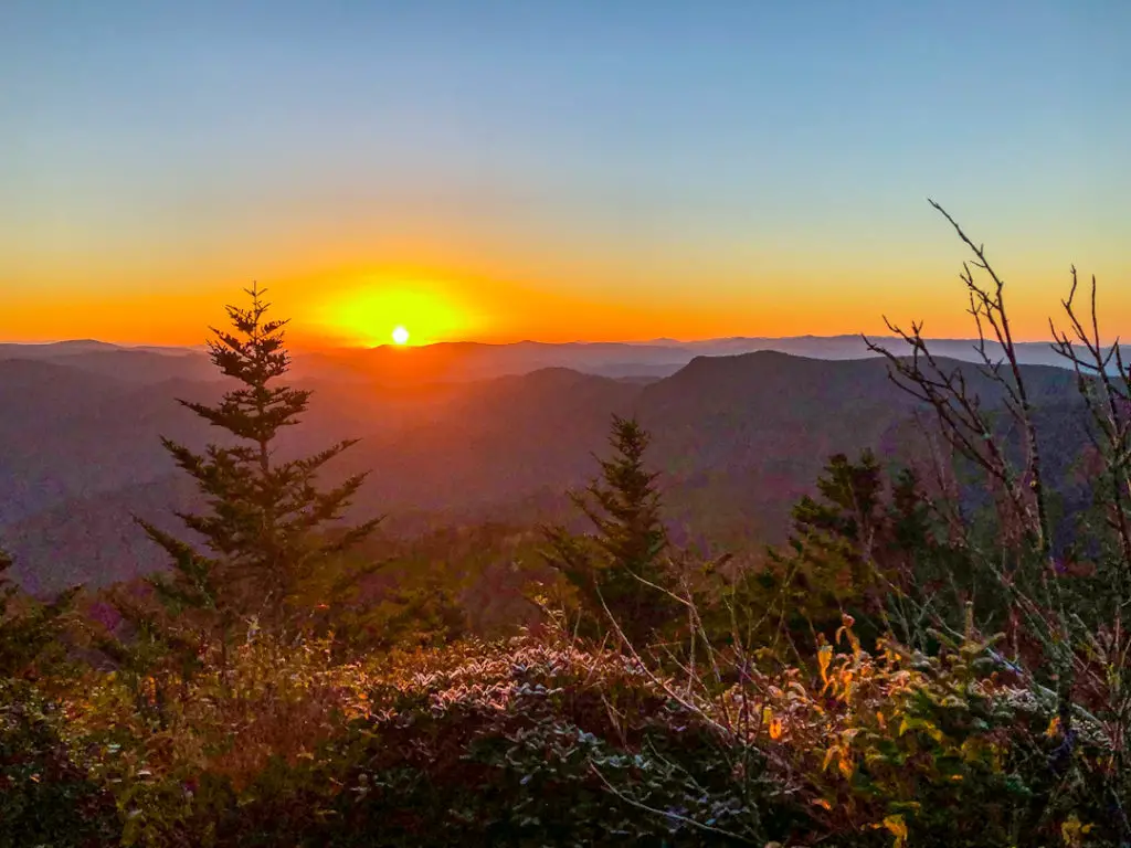
If day hiking Mount LeConte wasn’t enough of a challenge, you’ll love spending a night on the summit. A backpacking trip affords you the ability to watch sunset from Clifftops and sunrise from Myrtle Point.
There are two options for sleeping on the summit: the LeConte Lodge and the backcountry shelter.
The LeConte Lodge is the only lodge in Great Smoky Mountains National Park. It’s typically open from March-November. Guests hike in and stay in a cozy cabin, each with its own deck. Breakfast and dinner are served in the fire-heated dining area. There are no proper showers, no electricity and composting toilets. For this limited backcountry luxury you’ll pay $168 per person, per night. There is often a waiting list of months-years.
If you can’t afford the lodge, the backcountry campsite is a lovely alternative. You can pitch a tent in the yard or sleep in the shelter. There’s a privy and a water source (you can also use the pump at the lodge, but it’s turned off in cold weather). Bear cables are provided. Reserve in advance here — LeConte is an extremely popular shelter and you’ll need to book as soon as it becomes available, 30 days before your trip.
Regardless of which option you choose, expect nighttime temperatures in the 20’s until June and after September.
What time of year should you attempt a Mount LeConte hike?

Great Smoky Mountains National Park is a year-round hiking destination. However, there are pros and cons to attempting LeConte in each season.
Spring is typically wet and chilly in the Tennessee mountains. Mornings often start in the 20’s or low 30’s, and rain showers are common. However, you’ll be rewarded with spectacular wildflowers throughout your hike. May is best for mountain laurels at the higher elevations, but you can also encounter ice until June.
Summer is warm-but-not-hot — nighttime temperatures on the summit drop into the 40’s. Afternoon thunderstorms are a daily occurrence, and can be extremely dangerous on exposed stretches of trail. (Alum Cave, Bullhead and Boulevard are best avoided in summer.) This is also peak tourist season in the Smokies, so most trails will be packed, and waterfalls are at minimal flow.
Autumn brings colorful leaves and big tourist crowds in October. It’s chilly again — I camped in 26-degrees on LeConte in early October — but usually dry. September and November see a fraction of the crowds and you’ll usually get some color at some elevation. Ice is common near the summit after September.
Hiking Mt LeConte in winter is a viable under two conditions: If you can get to the trailhead, and if you have the gear. Route 441 (access to Boulevard and Alum Cave) closes in icy or snowy conditions, often without warning. The trailheads near Gatlinburg are accessible year-round.
6,000-foot mountains in Appalachia can be serious alpine terrain in winter. Some years, at some times, a hike up LeConte can involve post-holing in waist-deep snow. All years, at virtually all times, microspikes are a non-optional piece of gear. Even if it’s 65 and sunny near the summit, the shady sides of the mountain (i.e. that last 0.3 miles to Clifftops) will bring sheets of thick, solid ice. It is not safe to attempt the hike without spikes between November and March. Warm, waterproof and windproof gear is also essential.
I always carry my Yaktrax on a hike to Mt. LeConte. They make navigating icy rock faces a breeze.
A few random hiking Mt LeConte tips

- With the exception of Bullhead, all the Mt LeConte trails are popular. Start by 8 am or expect to be surrounded.
- Parking is an issue at all trailheads. Again, arrive early — I’ve never had trouble getting a spot before 8 am.
- There is a water pump at the LeConte Lodge. It’s reliably working in summer, but the staff turns it off whenever the temperature drops below freezing. Carry at least 3L of water between September and June, or bring a filter to use the spring at the top of the Trillium Gap trail.
- Definitely stop in at the lodge for a t-shirt or other souvenir if you make it to the summit!
- Great Smoky Mountains National Park is one of the only free national parks to visit in the United States. To help keep the park free, please carry out all your trash and only park in designated areas — the park doesn’t have the resources to clean up after you!
- Stay at least 100 feet away from wildlife and only deposit trash in bear-safe trash cans. If you encounter a bear, make lots of noise while backing away slowly. Commercial bear bells are too quiet to scare away bears.
Like this post? Pin it!

Read more about North Carolina here
The Alum Cave Trail looks just gorgeous. I would love to see it after reading this article. You have some great tips on here about Mt. Leconte. Thanks for sharing!
Nice Carrie! You found sooooo many fun sounding hikes! It is slightly mad that those trails were so busy, even with ice on the ground…I guess it must be a super popular area in the summertime!
I love the look of both the easy and the harder trails. But the backpacking trail sleeping up at the LeConte lodge has to be the coolest option!
I love those hiking trails and I bet that is must be amazing to hike there!
This looks like an awesome place to hike. The views on the Alum Cave Trail are stunning!