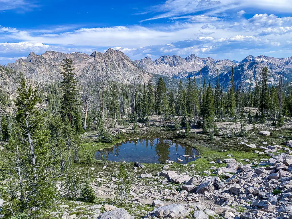
Idaho is so much more than potatoes. Over 60% of the land in this Rocky Mountain state is public. You can camp just about anywhere, hike the 10,000-foot peaks, and unwind in the hot springs. The Sawtooth Mountains near Stanley are one of the highlights, with dozens of alpine lakes to explore. Hiking in Stanley, Idaho rivals anything you’ll find in the Western U.S. — without the hassle of competitive permits.
The Sawtooths get their name from a set of jagged peaks clocking in at just over 10,000 feet. But despite their ruggedness, these mountains are very hiker-friendly — well-established trails make it easy to traverse the high passes and wildflower fields. The region is a backpacker’s dream — I hiked for 7 days and camped at a different lake every night — but there’s plenty for day hikers, too.
In this post, I’ll share the most scenic day hikes near Stanley, Idaho. Grab your daypack, pack a lunch and let’s get started!
Note: This post may contain affiliate links. If you decide to purchase through these links, I receive a percentage of the sale at no additional cost to you.
FAQ’s for hiking in Stanley, Idaho

Before we get into specific trails, let’s talk logistics. The Sawtooths are serious mountains, and if you aren’t prepared, you could easily get into trouble in an area with absolutely no cell service.
What time of year can you hike in the Sawtooths?
Hiking is one of the best things to do in Stanley, Idaho year-round. But most hikers visit between June and September. During summer, the high passes are mostly clear of snow, the rivers are safe to cross, and you won’t need technical gear for winter expeditions.
If you hike early in the season, it would be a good idea to bring microspikes. I visited in July and there was knee-deep snow over 9,000 feet. Additionally, be prepared for waist-deep or deeper river crossings in strong currents as late as July.
No matter when you go hiking in Stanley, Idaho, prepare for cold nights and mornings. Even in summer, temperatures often drop into the 30’s Fahrenheit at lower elevations. The good news is it warms up fast — summer highs are in the 70’s up high. And summer mornings and evenings are a great time to hit up the hot springs in Stanley to relax your muscles before or after your hike.
Storms aren’t super-common here like they are in the Colorado mountains, but they happen. Check the weather before heading out on a hike that goes above 8,000 feet.
Permits and land management
Several land management schemes protect the area around Stanley. There are four different wilderness areas (a special designation of national forest that minimizes human intervention), as well as a national recreation area. It’s all part of Sawtooth National Forest.
One of the biggest selling points for hiking in Stanley, Idaho is that you don’t need competitive permits for anything. No advance applications, no obsessively logging in to recreation.gov at 8:56 am and refreshing your screen every two seconds six months before your planned departure date. You can just show up and hike.
However — all hikers who enter Sawtooth Wilderness Area must fill out a free permit at the trailhead and carry it with them the entire time they hike. This is a crucial safety intervention that makes it easier for rangers to find you if you don’t make it back as expected. If you start a hike in the recreation area, there will be a permit station when you cross into the wilderness.
Can you bring your pup?
Dogs are allowed. They must be leashed from July 1st through Labor Day.
What is the terrain like?
Considering the size and ruggedness of these mountains, the hikes in Stanley are all pretty easy-moderate. (The exceptions are places you’re unlikely to end up on a day hike.)
Some of the hikes covered in this post accumulate up to 3,000 feet of elevation. But don’t worry — everything is beautifully switchbacked. It’s rare to find anything truly steep in the Sawtooths, even on the high passes.
Most trails stay within an elevation range of 7-9,000 feet. The lower you are, the more blowdowns there are. This is pretty exasperating in places, like along the Alpine Way Trail. The blowdowns aren’t an issue once you cross 8,000-ish feet.
On the high passes, you’ll encounter scree, very narrow/exposed trails, and sometimes snow. The only pass that really freaked me out was Sand Mountain, where the trail was only about 6 inches wide, very scree-y and there was a 500+ foot dropoff. The more heavily trafficked passes won’t alarm even the most height-averse hikers.
If you stay on-trail, you won’t have much scrambling to contend with. However, if you explore the higher lakes with no maintained trails to them, you may have to cross boulder fields. I’ve noted the hikes that were scramble-y below.
The only places I encountered annoying amounts of overgrowth were in areas that aren’t reachable on day hikes. All the trails below are blissfully briar-free.
What about navigation?
So, good news — if you’re used to hiking on the East Coast, the ease of navigation when hiking near Stanley will be a breath of fresh air. The Sawtooths have a sign at nearly every trail junction. When there is no sign, it’s pretty obvious where you should go. And there aren’t a bajillion social trails everywhere (except at the lakes, where they take you to campsites).
Still, it’s super-dangerous to head out into big mountains without a map and compass (and the knowledge to use them). National Geographic produces an excellent map of the area.
Theoretically you could rely on AllTrails or Gaia. But there’s no cell service in the Sawtooths, so you’d need to download maps in advance. Additionally, hikers who plan to refill water on the trail should be aware that streams and rivers are largely mis-marked on AllTrails — the app shows them much closer to the trail than they actually are, in places where it would be dangerous to try to reach them.
The best day hikes in Stanley, Idaho and the Sawtooths
Now that we’ve got the logistics out of the way, let’s talk trails! If you’re looking for the best hikes in Stanley, Idaho, these hikes are a good start.
I’ve listed the hikes below from easiest to hardest. You’ll quickly notice there are few truly easy hikes near Stanley. Distances are long and just about everything has a couple thousand feet of climbing. But I promise the elevation gain is moderate and the distance goes by fast when the views are this awesome!
1. Hell Roaring Lake via Hell Roaring Creek

If you want a pretty lake, a lot of pine forest, a rushing creek, and not a lot of difficulty, this is the day hike for you. The Hell Roaring Creek trail is one of the flattest routes in the area, but the payoff is one of the best swimming lakes in the Sawtooths.
This hike is super straightforward. You start at the trailhead, you hop on the Hell Roaring Creek Trail, and you follow it for 5-ish miles. That’s it. That’s the whole hike. There are a couple small creek crossings, but nothing you can’t rock-hop in summer.
You could make this hike even shorter by taking the Upper Hell Roaring Creek Trail. It cuts about three miles off, but otherwise the trails are very similar.
The only unfortunate thing about this area is the blowdowns. There are tons of dead ponderosa pines that keep falling across the trail. It can be really tiring to climb over 30+ blowdowns on a hike of this length! Also, knowing the number of trees that are about to come down, I’d steer clear of this whole area in high winds.
The best swimming spots on Hell Roaring Lake are along the southern shore. The river that flows out of it is also an awesome spot to stick your feet in.
Hike details
Trailhead: Hell Roaring Creek
Distance: 10 miles
Elevation gain: 700 feet
Difficulty: Easy
Hiking time (without long breaks): 4-5 hours
Views: 4/10
Swimming: 8/10
2. Bench Lakes (Lower two lakes)

The Bench Lakes are an easy intro to hiking in Stanley, Idaho. You never get above the treeline, there are no high passes to cross, it’s mostly in the shade, and the switchbacks are minimal. But the reward is excellent — the second lake is one of the most peaceful places in the wilderness area.
The hike begins from Redfish Trailhead, near the lodge. Hop on the Redfish-Baron Creek Trail (a left turn across a bridge) and stick with it for about 2.5 miles. It climbs gradually, but the trail is wide and easy.
The only intersection is very clearly marked to your right. It’s a mile up moderate switchbacks through a wildflower field to reach the second lake. This is a fabulous camping spot — I had the whole lake to myself — and brilliant for swimming, too. Just be careful in the wind, as there are lots of dead trees around.
Most hikers should stop here. However, if you are an experienced off-trail traveler, you can continue to the two upper lakes. This route does not have a defined path. It requires significant boulder climbing and navigating a very steep scree slope. The AllTrails map can give you a general idea, but the true route diverges significantly at the boulder field and along the shore of the third lake, before becoming a barely identifiable manway that roughly synchs up with AllTrails again on the approach to the fourth lake. Be prepared to climb 1,000 feet in a mile.
The good news: The fourth lake is the prettiest, and if you make it to the third you can definitely get to the fourth. The bad news: It’s a lot harder and more dangerous coming down.
Hike details (for the first two lakes only)
Trailhead: Redfish Trailhead
Distance: 8 miles
Elevation gain: 1,200 feet
Difficulty: Easy-moderate
Hiking time (without long breaks): 4-5 hours
Views: 6/10
Swimming: 8/10
3. Marshall Lake

If you want to experience the lower elevation hikes around Stanley, Idaho, Marshall Lake is a decent day out. It won’t knock your socks off — the lake itself is rather underwhelming — but the views of Thompson Peak on the way up are excellent. This trail also had the best wildflowers I saw in the area. And you’ll encounter a fraction of the crowds compared to Alice Lake or Sawtooth Lake.
The hike begins from Redfish Trailhead. Follow the Fishhook Trail through the big field (don’t cross the bridges to your left) until you reach the turnoff for the yurt. Then, continue straight to hop on the Alpine Way Trail. You’ll know you’re in the right place if you start ascending fairly quickly.
The best views are in the first 2-3 miles, as you walk through open fields full of red and purple flowers. Thompson Peak and Williams Peak are visible every couple minutes. Plenty of short spurs to your left lead to spectacular views along the way.
Three miles in, you’ll come to an unmarked spur that scramblers use to reach Thompson Peak. It looks viable at the beginning, but this is not a trail for inexperienced climbers — it gets quite dodgy and snowy quite quickly. It also climbs over 2,000 feet in a mile. I couldn’t do it with my pack, and I wouldn’t recommend it without snow gear any time of year.
It’s only another mile to Marshall Lake. You’ll know you’re close when you rock-hop a small stream. The turnoff is to your left. It’s overgrown but very short. You can also spot the lake as you approach, coming down the switchbacks from above, if you aren’t sure where to turn.
Hike details
Trailhead: Redfish Trailhead
Distance: 9.5 miles
Elevation gain: 1,800 feet
Difficulty: Moderate
Hiking time (without long breaks): 4-5 hours
Views: 6/10
Swimming: 2/10 — the mosquitoes in July were bad
4. Goat Lake

Goat Lake may be one of the shorter day hikes in Stanley, Idaho, but it’s not easy. The trail begins with a climb and ends with a scramble. The last 1.2 miles climb 800 feet and are not on a maintained trail. But the lake — and the waterfall you pass along the way — are worth the effort.
Start from Iron Creek Trailhead and climb just over a mile to the junction with Alpine Way. Take a left, and you’ll immediately start the moderate climb that will define most of your day.
The Alpine Way in this direction is probably the most blowdown-ridden trail in the Sawtooths. There were places I couldn’t make it more than 20 feet between trees I had to climb over. It makes the hike slow going the entire way.
Two miles along the Alpine Way, you’ll hit a junction that you might not even notice. The trail to Goat Lake is the more obvious one, and it goes straight. The Alpine Way takes a sharp turn to the left. Continue straight.
This is where the serious climb starts. The footing gets bad, and the further up you get, the more scrambly it is. But you won’t mind as you pass Goat Falls, quite possibly central Idaho’s prettiest waterfall, and eventually reach the glacial lake. Snow is common up here year-round.
A word of warning: This hike has gotten mildly Instagram-famous. But it’s not easy and it’s not safe without proper gear and training. Not only are there boulder scrambles, there are also stretches where it’s hands-and-knees over loose dirt. Poles, good boots, and microspikes early in the season are the bare essentials. A whistle would be a good idea in case you take a nasty fall.
Hike details
Trailhead: Iron Creek
Distance: 8.1 miles
Elevation gain: 1,800 feet
Difficulty: Difficult due to scramble at the end
Hiking time (without long breaks): 4-5 hours
Views: 7/10
Swimming: 6/10
5. Sawtooth Lake Hike from Iron Creek Trailhead

Sawtooth Lake is one of the most accessible day hikes in the Sawtooth Range. Starting from Iron Creek Trailhead, it climbs up to this large, rocky, very exposed, and crystal-clear lake amidst 9,000-foot peaks.
The trail begins in the forest and climbs gradually at first. 1.1 miles in, you’ll hit the end of the Iron Creek Trail, where you take a right. It’s not far before you hit your left turn (clearly marked) to Sawtooth Lake.
You stay in the forest for about 2 more miles, eventually hitting a stream crossing. When I hiked in July this stream was rock-hop-able. It’s the only great water source on the route.
Once you cross, the climb gets steeper and more switchbacked, but you’re still below the tree line. You pop out on a rocky slope at the intersection to Alpine Lake — a worthy (and quick) diversion. Alpine is more off-the-beaten-path, and 700 feet lower, so it makes a good swimming spot if you need a break.
The last mile is nothing but exposed switchbacks. They aren’t steep, but they seem to go on forever. You’ll come out at the north end of the lake, where a little peninsula to the right of the trail houses a few campsites and the best swimming holes.
If you’ve got any energy left, I highly recommend walking the length of the lake and beyond, to the two smaller lakes past Sawtooth. While the lakes themselves aren’t super special, they’re in an incredible high-alpine setting that looks like nowhere else in the area. Mount Regan soars above 10,000 feet to your right, and you can even see Baron Peak in front of you. This diversion adds a rather rocky 3 miles to the hike.
Hike details
Trailhead: Iron Creek
Distance: 10 miles if you stop at the north end of the lake
Elevation gain: 1,900 feet
Difficulty: Moderate
Hiking time (without long breaks): 5-6 hours
Views: 6/10, especially coming down from Sawtooth Lake and seeing Alpine Lake below
Swimming: 5/10; it’s cold and exposed up here
6. Alice Lake

Alice Lake is probably the most popular day hike in the Sawtooths. And for good reason. The ampitheater of 10,000-foot peaks that surrounds it is spectacular at sunrise, sunset, and anytime throughout the day. But every minute of the journey is beautiful as well. If you have to pick one hike in Stanley, Idaho, this is the one to choose.
Start at Tin Can Trailhead near Pettit Lake and take the clearly marked trail that hugs the lakeshore. Almost immediately you’ll pass a junction to Yellowbelly Lake — stay left. Pettit Lake offers a nice glimpse of what’s to come, but with a car campground right there, it’s a little commercial.
The trail climbs gradually through wildflower fields for the first mile or so, and then intersects a roaring river. In July, there were waterfalls all along the river. Around the 2.5-mile mark, you’ll have two crossings almost back-to-back — they were knee-deep wades when I hiked.
After the last crossing, you quickly feel like you’re in the alpine zone. First it’s a set of switchbacks through a scree field — be sure to look behind you for epic views of 11,000 foot peaks in the distance. Then, you’ll scramble across a boulder field if you want (there are two route options here; one through a muddy river and the other a scramble).
On the other side of the boulders, you have just a little more climbing before you reach the lakeshore. It’s worth walking at least halfway around — the best views of the mountains are from the little peninsula with tons of campsites around the middle of the lake.
Hike details
Trailhead: Tin Can
Distance: 12 miles
Elevation gain: 2,000 feet
Difficulty: Easy-moderate
Hiking time (without long breaks): 6-8 hours
Views: 8/10 during the day; 10/10 for sunrise or sunset
Swimming: 7/10
7. Imogene Lake

Imogene Lake takes the award for “best swimming lake in the Sawtooths.” Nestled between two high passes, with steep cliffs on all sides and islands in the middle, you could spend a whole day lounging here.
There are several options to day-hike Imogene, but most of them are long (20+ miles) and very hard. This 13-mile hike isn’t as scenic as the other routes but it’s much more doable for day hikers.
Start at the Upper Hell Roaring trailhead and follow the directions for Hell Roaring Lake. Once you reach it, take a left and continue along the eastern lakeshore.
The climb begins as soon as you cut away from Hell Roaring Lake. It’s a moderate climb, but it goes on for about 3.5 miles with no views to speak of. Still, the setting — with a whole ridgeline of 10,000-foot peaks in front of you — is spectacular.
When you reach Imogene Lake, it’s well worth hiking along the shore for awhile. Because there are so many big mountains around it, the views and reflections are different from all angles.
Once you’ve soaked in the scenery, don’t miss the chance to swim here. The best swim holes are on the south side of the lake, near where a large creek (big enough to be marked on maps) crosses the trail. Swim out to the islands, where there are big rocks you can jump off. If you’re lucky enough to have camping gear with you, you could camp for a few days without getting bored. I saw lots of folks with fishing poles as well.
Hike details
Trailhead: Upper Hell Roaring Creek
Distance: 13 miles
Elevation gain: 1,500 feet
Difficulty: Moderate
Hiking time (without long breaks): 6-7 hours
Views: 7/10
Swimming: 10/10
8. Alpine Lake

There are two Alpine Lakes in the Sawtooths — the one below Sawtooth Lake, and the one below the Barons. The first one is a nice side trip, but the latter is truly spectacular. Luckily, it is reachable on a moderate day hike.
This hike begins exactly like the Cramers — with the shuttle across Redfish Lake and then the climb up to the river crossing. But where you went left for the Cramers, you’ll go right here.
As soon as you leave the river, the Alpine Lake hike gets good. You climb up a set of switchbacks with views across the glacial valley that rival anything in Glacier National Park. Snowmelt-fed streams trickle down, wildflowers are everywhere…it’s just magical.
The character of the switchbacks changes as you get higher — you go back into the forest and hug some rocky cliffs for the last mile or so. But you never really stop switchbacking until you reach the lake.
Alpine Lake would be a phenomenal midweek camping spot. When I rolled through at 6 pm on a Tuesday there wasn’t a single tent set up. The swimming is divine, and it has that perfect “high peaks reflected in clear water” vibe.
Hike details
Trailhead: Redfish Inlet
Distance: 11.5 miles
Elevation gain: 2,000 feet
Difficulty: Moderate
Hiking time (without long breaks): 6-7 hours
Views: 9/10
Swimming: 9/10
9. Cramer Lakes

If I’d known what the Sawtooths looked like in advance, Middle Cramer is the lake I would have planned my entire trip around. This idyllic blue swimming hole is fed by a waterfall and ringed by some of the most atmospheric mountains in the region, including the 10,000-foot “Temple” formation.
The Cramers make a phenomenal backpacking trip, especially if you continue up and over the pass to Hidden Lake. But they’re a viable day hike as well, thanks to the boat shuttle across Redfish Lake.
Start your day at the Redfish Marina, where you pay $22 for a round-trip ride and wait for a group of at least two hikers to get the boat across the lake. This saves you six miles each way of hiking. The boat drops you at Redfish Inlet, which has restrooms, clean drinking water and trash cans.
You’ll be climbing the whole way to the Cramers, but it’s gradual and very scenic. As you stroll through the wildflower fields and glacial valleys, the peaks on either side just keep getting bigger and snowier.
About three miles in, you’ll reach a river. The trail to the Barons splits off to the right, but you have to cross. This was the most intense river crossing I encountered in the Sawtooths — the water came up to my waist and it took awhile to find a safe spot to cross. You may have to hike through the campsite and go up-river a bit to find a wider, calmer place. I doubt this crossing would be safe before June.
It’s another 3.5 miles to the Cramers, and the climb picks up a bit but never gets super-steep. You’ll pass some smaller snow-fed streams that are achingly beautiful, and the Temple comes into view in front of you. Finally, you’ll see tiny Lower Cramer to your right. Middle Cramer is just a short stroll further, with the bluest water you’ll ever see. The uppermost lake isn’t quite as spectacular, but it’s much larger and has some great campsites. Swimming in either of the upper two lakes is heavenly.
Be sure to get back to Redfish Inlet in time to meet the scheduled return departures of the boat at 12pm, 3pm or 5pm.
Hike details
Trailhead: Redfish Inlet
Distance: 13 miles
Elevation gain: 2,000 feet
Difficulty: Moderate
Hiking time (without long breaks): 7-8 hours
Views: 9/10 — +3 for Middle Cramer being so spectacular
Swimming: 9/10
10. Baron Lakes

Ok, I’ll be honest — the Barons push the limit of what’s possible on a day hike in the Sawtooths. This is a long, tough trail, and by day hiking it you’ll miss the good light on both ends of the day. If you can backpack it, you’ll have a much better experience.
But if the only way you can see the Barons is by day hiking them, do the day hike.
Truthfully, you don’t even have to go to the lakes. The highlight of this trip is summiting the Baring Divide. This 9,000+-foot pass offers the best views in the entire range. Trust me, I crossed every high pass in the area and this one took the cake.
The hike begins exactly as Alpine Lake above. You’ll need to get a very early start to make it back to Redfish Inlet in time to catch the 5 pm boat.
Once you reach Alpine Lake, stay along the lakeshore and start switchbacking up on the other side. AllTrails has an intersection marked here for a manway taking you to some lakes above Alpine, but the real trail is obvious (and you’ll want to stay on it).
You’ll think you’re about as high as you’re going to go as you pass a couple small lakes below Monte Verita. But no — you have another 1,000 feet to climb. After a gradual stroll through the fields beside these small lakes, the switchbacks begin again in earnest. But this time, the views of the entire Sawtooth range distract you from every step being a struggle.
Even once you reach the top, it just keeps getting better. Cross the threshold to the other side of the pass and watch the Barons appear 1,000 feet below you. It feels like you’re on top of the world.
The descent to Upper Baron is brutally steep, but it stays scenic the entire way. Once you reach the lake, the best swimming area is on the northwest shore. Or, continue to Lower Baron — which I thought was prettier, especially at sunset. There are tons of campsites at both, but only one other group there on a weeknight.
The worst part of day-hiking the Barons is you need to go back up and over the Baring Divide on the return. It’s a lot of climbing without much of a break. But I promise it’s worth the effort.
Hike details
Trailhead: Redfish Inlet
Distance: 17 miles
Elevation gain: 3,600 feet
Difficulty: Difficult
Hiking time (without long breaks): 8-10 hours
Views: 10/10
Swimming: 10/10
I hope this gives you a few ideas for hiking in Stanley, Idaho!
Like this post? Pin it!

So many beautiful day hikes in Idaho! I would like to do the Alike Lake and Imogene Lake hikes when I get to visit the area!
Yessss. If you like camping, you can string those two together on a one-night backpacking trip – it’s a way prettier way to see Imogene since you approach it from the 10,000-foot pass above it.
I never expected Idaho to be a great hiking destination. This post proves otherwise. Everything looks so pretty! Love the mountains
Right?? It’s so unknown as a vacation spot but it really is amazing.
I have only hiked here once and I am dyinggg to go back. Thank you so much for sharing.
I hope you get to go back soon! It’s definitely one of those places you could visit again and again and never run out of trails.
I haven’t had the opportunity to hike in Idaho much. Looks like there are many hikes that are perfect for taking scenic photos.
For sure, if you like photography you’d love the Sawtooths!
Your photos are beautiful! I hadn’t heard of this place before, but now it’s definitely on my list to visit. Thanks for sharing!
Yeah, it’s amazing how off-the-radar it is considering how great the scenery is!
Cramer lakes look spectacular. I would love to see that in person.
They really are beautiful!